LCA 4: Ironstone Hills and Valleys
Location and key characteristics
The Ironstone Hills and Valleys are found in the north-west of the district, extending from the Cherwell Valley to the Oxfordshire and Warwickshire county boundaries. This is an upland area which, along with the Incised Ironstone Plateau to the north (LCA 5), forms part of the northern extent of the Cotswold Hills. The Cotswolds National Landscape (formerly known as an AONB) extends into the north-west of the Character Area around Epwell.
- Complex topography, cut through by numerous small streams, including the Rivers Swere and Stour, creates very steep sided valleys with narrow bottoms and rolling, rounded hill lines.
- The underlying Ironstone geology produces characteristic iron-rich, red soils and also gives rise to characteristic warm orange-brown buildings, located in a strong settlement pattern of compact, nucleated villages which retain a rural character.
- There is a well-defined pattern of mixed agriculture enclosed by prominent hedgerows and trees. Larger-scale arable fields are more common on higher ground, contrasting with smaller pasture fields in the valleys. Mature hedgerow trees and copses create a well-wooded character, despite a lack of larger woodlands.
- Compact, nucleated villages retain their historic buildings, and are often designated as Conservation Areas. Settlements are typically linked by straight roads, with many sunken lanes.
- There is strong time-depth across the landscape, including the prominent Iron Age forts visible on the hilltops, and Broughton Castle.
- Long, open views from higher ground contrast with stronger enclosure along valleys, giving the latter a more intimate character.
- This is a highly tranquil landscape, especially in the west, with good experience of dark night skies.
Stone bridge over the River Swere

×![]()
Stone bridge over the River Swere
Open undulating landscape, with solar farm in middle distance

×![]()
Open undulating landscape, with solar farm in middle distance
Broughton Castle and parkland

×![]()
Broughton Castle and parkland
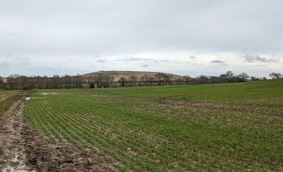
Iron Age fort Madmarston Hill rising above arable fields
×![]()
Iron Age fort Madmarston Hill rising above arable fields
Description
Natural (landform, water, semi-natural land cover)
- The geology of the Ironstone Hills and Valleys is faulted and fairly complex, which gives rise to a correspondingly complicated topography. Marlstone Rock Formation, an iron-bearing limestone with local sandy deposits, overlies the Middle and Lower Lias valleys. This highly coloured ironstone gives the landscape its name.
- Faulting has uplifted an area of White Limestone and Northampton Sandstone, around Tadmarton and the Sibfords. A second line of faults lies along an east-west line from Hook Norton, through Wigginton, South Newington and the Barfords.
- Since the area is faulted and uplifted, and also cut through by numerous small streams, the landscape is divided into very steeply sided, convoluted valleys, with narrow valley bottoms often over 60m beneath the rolling, rounded hill lines that separate them.
- Main drainage routes follow the fault lines. To the south, the River Swere flows eastwards along fault lines running into the Cherwell and subsequently draining to the south-east into the River Thames. The River Stour rises in the vicinity of Wigginton Heath and, joined by minor streams from the Sibfords, flows westwards into the Avon. Thus, the hills form part of a major watershed which divides the drainage system of the Severn from that of the Thames.
- Semi-natural habitats are relatively uncommon and are confined to small priority habitat deciduous woodland on valley sides, and good quality semi-improved grassland and floodplain grazing marsh adjacent to the small watercourses. One SSSI, Hook Norton Cutting and Banks, is designated for its calcareous grassland flora and fauna.
- Unmanaged hedgerows and road verges with narrow stands of trees create a well-treed impression, although the area lacks larger woodlands. Streams in valley bottoms are locally marked with old willows, with some pollarding, and with wet pasture. Many of the hedges contain mature hedgerow trees, the dominant species being oak and ash, with beech on the limestone outcrops. The hedges also have an extremely high elm component, and where young trees are regenerating naturally, this is the dominant species.
- In the highest and most exposed areas, patches of gorse, bracken and scrubby heath vegetation break up the poor grasslands. These upland vegetation patches contribute considerably to the character of the area, serving as a reminder of its essentially upland heath nature.
Cultural/social (land use, settlement, infrastructure, historic character)
- Rolling hills with rich soils (largely classed as Grade 2 agricultural land) result in considerable arable cultivation, the main crops being winter cereals, potatoes and sugar beet. Medium and large arable fields on the higher ground are bounded by hedges and hedgerow trees. Hedgerows are mostly dense, well-grown barriers, although some are closely trimmed. In contrast, the gentler slopes now have a fairly open arable landscape, with local areas where clearance has been so extreme that even post and wire fences have not been retained to demarcate field boundaries. There is a more open character where hedgerows have been removed around Wigginton Heath and Tadmarton Heath.
- Small-scale permanent pasture dominates the steep-sided valleys and narrow valley floors. Many hedgerows here are unmanaged and growing out.
- The Oxfordshire Historic Landscape Characterisation (HLC) indicates a strong historic field pattern, with a mix of 19th century planned enclosure, piecemeal enclosure and reorganised enclosure. Areas of 20th century prairie / amalgamated enclosure are scattered across the hills.
- The historic settlement pattern remains, with villages positioned in valley locations, either on the valley sides, at the head of a valley, or near the top of the valley on the brow of the hill. The majority of the villages, including Barford St Michael, Milton and Sibford Ferris, have designated Conservation Areas and contain a number of listed buildings.
- Outside of the villages, farmsteads and farm buildings are dispersed throughout the area. Although some are close to roads, many lie at the end of access tracks, away from the main through routes.
- Lanes and minor roads typically run straight along ridges, dipping sharply down the valley sides to connect with villages. Banks which would have been topped with hedges still remain along roadsides. Sunken lanes are a particular feature of this area, with steep banks rising on either side of the roads as they dip down the valley sides. Occasionally, these banks are reinforced by drystone walling, many of which are overgrown by hedgerow plants.
- The tree-lined A361 is the only main road in the area, connecting to Banbury to the north-east. The Banbury/Cheltenham railway line was opened in the 19th It was closed and dismantled in the late 20th century, although some large earthworks and pillars still remain.
- Quarrying has had a considerable impact on the landscape with some reclaimed fields several metres below the natural level of the land.
- There is a strong consistency in the vernacular architecture of this area. Two-storey terraced and detached houses built of ironstone are characteristic. Duns Tew is the exception, where limestone predominates. Early 19th century brick buildings are largely found in villages close to Banbury, although other villages on railway lines, such as Hook Norton, were influenced by the introduction of new materials.
- A distinctive line of Iron Age hill forts, which top the hills to the west of Banbury, are some of Cherwell’s oldest features. These include Scheduled Monuments at Tadmarton and Ilbury Camps and Madmarston Hill, where the earthworks are still highly visible. A further three hill fort sites are known. The bivallate hillfort at Tadmarton is the most impressive, although it is now bisected by a road and absorbed into a golf course. Some areas of ridge and furrow are evident, and particularly prominent on hill slopes.
- Broughton Castle also adds considerable time-depth to the landscape. Built in the early fourteenth century as a fortified manor house, it remains one of the finest and most complete medieval houses in the country. The eighteenth century park by John Davenport includes landscaped grounds with a moat, with the late nineteenth century gardens were laid out by Gertrude Jekyll. Broughton Castle is now a Grade II Registered Park and Garden. The later picturesque parkland at Swerford, which lies partly within Cherwell and partly within West Oxfordshire, was influenced by Loudon.
- The practice of hedge-laying is still continued locally as a means of maintaining a stockproof boundary.
Perceptual (views, tranquillity, associations)
- Hills are prominent features in views, and also provide opportunities for long-distance views. The ridge in the west in particular provides extensive views over much of the area and westwards into Warwickshire, for example from Oatley Hill. Two long distance paths, the Macmillan Way and the D’Arcy Dalton Way, facilitate public access.
- Villages are generally only prominent where the valleys are open and wide, e.g. the Barfords in the Swere valley. Elsewhere topography means that many villages are not visible over long distances. Churches located near the highest point of the village provide a landmark in the wider countryside. The dismantled railway running east from Hook Norton is still highly visible in the landscape due to the upstanding support pillars.
- Incongruous features include the disused airfield and wireless station near Barford, which is visually intrusive. Small solar farms are glimpsed in views across the valleys. There are small lines of overhead electricity pylons, which can be seen in close proximity.
- Despite proximity to Banbury in the north-east, there are high levels of tranquillity and remoteness throughout the landscape, due to an overall lack of modern development. The screening provided by valley landforms, associated trees and strong hedgerows gives these areas an intimate character., Banbury has a limited influence on the landscape, with views on the approach largely restricted by trees lining the roads including the A361. There are only lighting columns on the A2460, resulting in a rural and largely tranquil setting and approach to Banbury.
County landscape typology
- In the Oxfordshire Wildlife and Landscape Study (see the map at the top of the page) the higher ground in the Ironstone Hills and Valleys LCA is predominately classified as Upstanding Village Farmlands in the east and either Rolling Village Pastures or Farmland Plateau in the west. Small but distinct hills in the south-east and north-west of the Character Area are classified as Pasture Hills.
- The principal valleys that cut east-west through the higher ground, associated with the River Swere and Sor Brook, are classified as River Meadowlands, whilst other valleys or plateau-edge slopes are defines as either Farmland Slopes and Valley Sides or Wooded Pasture Valleys and Slopes.
Valued qualities
- The distinctive strongly undulating topography, with local hills and strong valley landform, provides scenic value and contributes to the settings of villages. It also represents a continuation of character from the Cotswolds National Landscape that serves as a buffer to the designated area. The area’s distinctive red soils contribute to its sense of place.
- Small watercourses including the River Swere and River Stour create topographic and visual interest.
- Strongly wooded character formed by small woodland blocks and prominent hedgerows and trees, which contributes to the rural character of the landscape.
- Important historic features, including Iron Age hillforts and Broughton Castle, provide time-depth within the landscape.
- The distinct, nucleated settlement pattern of traditional, rural villages, with a strong local vernacular of warm orange-brown buildings resulting from the underlying ironstone geology, creates a strong sense of place.
- Sunken lanes are a characteristic feature of the landscape, adding to its distinctive character.
- This is a highly tranquil landscape, especially in the west, with a good experience of dark night skies.
- A strong network of Public Rights of Way, including the promoted D’Arcy Dalton Way, provide recreational access.
Forces for change
- Some hedgerows are gappy and low, with reinforcement by post and wire or post and rail fencing. Around Wiggington Heath and Tadmarton Heath hedgerows are generally missing.
- Implementation of development allocations around Banbury will see increased residential development, particularly on the south-western edge of the town.
- Introduction of small-scale solar PV development into the landscape, which can be a jarring element in views across valleys, reducing the rural character. Net zero targets are likely to result in pressure for larger scale solar development and potentially for wind turbines on plateau locations.
- The landscape is susceptible to the impacts of climate change, including higher average temperatures and drier summers, wetter winters, more frequent winter storms and flooding leading to:
- Loss of woodland /trees due to wind-throw and of dieback in drought prone locations.
- Spread of non-native and invasive species such as giant hogweed.
- Changes in cropping and land use as a response to climate change impacting the character of the farmland.
- Drought conditions leading to crop failures, and reduced productivity changing the character of the farmed landscape.
Landscape strategy and guidelines
Conserve the historic environment, which contributes to the landscape’s character.
- Conserve the surviving areas of permanent and ridge and furrow pasture on the steeper slopes and hillsides.
- Safeguard, maintain and enhance the characteristic landscape features of parklands including veteran trees, avenues of trees, lakes, woods and walls.
- Maintain long distance views to the Iron Age hill forts, a key feature of the landscape.
Maintain the field pattern, hedgerows, small tree-lined water courses, and areas of grassland.
- Strengthen the field pattern by planting up gappy hedges using locally characteristic species such as hawthorn, and hedgerow trees such as oak and ash.
- In more open areas where hedgerows have been lost, for example around Wigginton Heath and Tadmarton, new hedgerow planting to restore the field pattern would be beneficial.
- Promote environmentally sensitive maintenance of hedgerows, including coppicing and layering when necessary, to maintain a height and width appropriate to the landscape type.
- Enhance and strengthen the character of tree-lined watercourses by planting willows and ash and, where appropriate, pollarding willows.
- Enhance tree cover through small-scale woodland planting next to streamlines and on steeper hillsides, so that it does not block off views of the landscape, keeping the feeling of openness.
- The Oxfordshire Treescape Project considers there are fewer sites with multiple benefits for woodland opportunities than within other parts of Cherwell District. Small areas are indicated on hill sides and on the edges of the historic villages.
- Conserve permanent pastures and all remnants of semi-natural vegetation including the distinctive patches of gorse scrub. Encourage conversion of arable to pasture where appropriate.
- Ensure that all priority habitats, particularly grasslands, are in favourable condition and management.
Preserve the tranquillity and strong rural character of locations remote from transport infrastructure and Banbury.
- Avoid development that would intrude on locations currently remote from urbanising influences, either through its size, scale or character, or its impact on levels of activity (such as traffic generation).
- Minimise the visual impact of intrusive land uses at the fringes of towns, villages and farms with the judicious planting of tree and shrub species characteristic of the area. This will help to screen the development and integrate it more successfully with its surrounding countryside.
- The exposed character of the plateau is particularly sensitive to visually intrusive development, large buildings and communication masts.
- Retain the tree-lined and unlit nature of roads, particularly on the approach to Banbury to conserve the rural approach to the town.
Retain the traditional character of the area’s villages.
- New development should not expand villages beyond constraints imposed by landform and ground water characteristics.
- The historic nucleated settlement pattern should be retained where possible. Ensure the scale of any new development does not detract / distract from the historic core of the village.
- Promote the use of characteristic ironstones and slate tiles of the local vernacular.
- Trees and hedgerows, which integrate villages into their landscape setting, should be retained. New trees and hedgerows should be planted in association with new development to maintain this character.
- Where Conservation Areas or Listed Buildings retain a strong relationship with open land avoid development that would weaken this link. New development should respect the views to, and setting of, important landmark buildings such as churches.